
By Jason Arnold | TideBandits.com
Fifty Miles Out and Looking for Answers
Fifty miles off South Padre Island, the Gulf changes character. The shoreline disappears, the water deepens and the Texas FAD network rises through the water column beneath the boat. These fish aggregating devices create structure in open water, gathering bait and giving pelagic predators a place to hunt. For fishermen, they can turn an enormous stretch of blue water into a series of high-percentage targets. For scientists, they offer a rare opportunity to study how billfish use the western Gulf of Mexico.
That was the reason for this trip. We joined a billfish tagging expedition off South Texas to help researchers put pop-off archival satellite tags on blue marlin and other billfish. The goal went well beyond marking a fish and hoping somebody caught it again. These electronic tags can record where a fish travels, the depths it uses and the water temperatures it encounters, building a detailed record of its life after release.
On the boat was Jeremy Higgs, assistant director of the Center for Fisheries Research and Development at the Gulf Coast Research Laboratory, University of Southern Mississippi. Higgs and his team have spent years studying billfish in the Gulf, but much of their work has focused on the north-central region. South Texas offered a chance to push that research west and begin filling a major gap in the map.
Why South Texas Matters
Billfish do not recognize state lines or management boundaries. Blue marlin and white marlin can cover immense distances, moving between feeding areas and across international waters. That mobility makes them difficult to study. A fish seen off Louisiana in one season could be hundreds or thousands of miles away later, and researchers cannot protect what they do not understand.
Jeremy Higgs, assistant director of the Center for Fisheries Research and Development at the Gulf Coast Research Laboratory said the South Texas expedition was designed to examine the habitat use and migration patterns of billfish in a part of the Gulf that has received less attention from his research group. Although billfish are highly migratory, the team’s earlier work in the north-central Gulf showed only limited movement into western Gulf waters. That raised an obvious question: Are the billfish off South Texas part of the same connected population, or are they using the region differently?
The data collected here can be compared with information from earlier tagging work in the northern Gulf. Researchers can then look for connections across the region, including whether fish move between these areas, how long they remain near certain habitats and whether they use similar temperature and depth ranges.
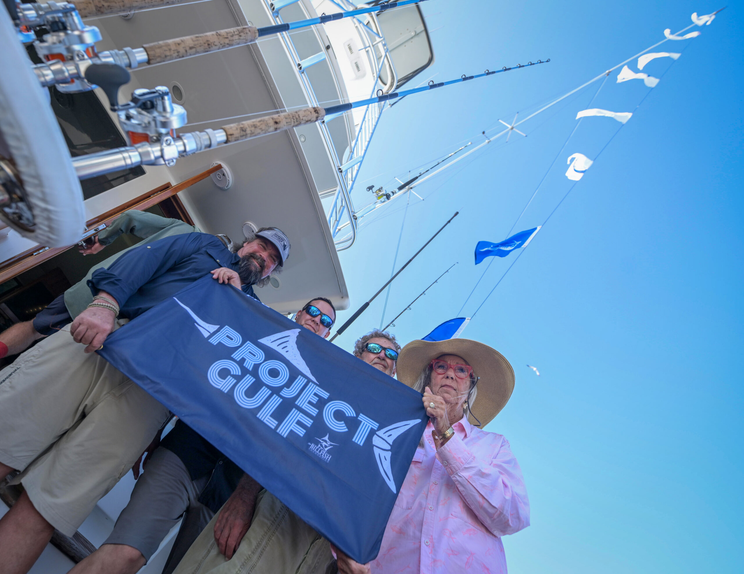
The expedition also supports work by the Center for Fisheries Research and Development and The Billfish Foundation through its Groundswell Projects. It is part of Project Gulf, an initiative focused on the movement and habitat use of blue and white marlin within the Gulf of Mexico and beyond.
What a Satellite Tag Records
Most fishermen have seen a conventional spaghetti tag. It is simple, inexpensive and valuable. If somebody catches the tagged fish again and reports it, researchers gain two known points: where the fish was tagged and where it was recaptured. That snapshot can reveal distance traveled, time at large and growth between encounters.
The weakness is built into the system. The fish must be recaptured, and the tag must be reported. Even when that happens, the space between those two points remains largely blank.
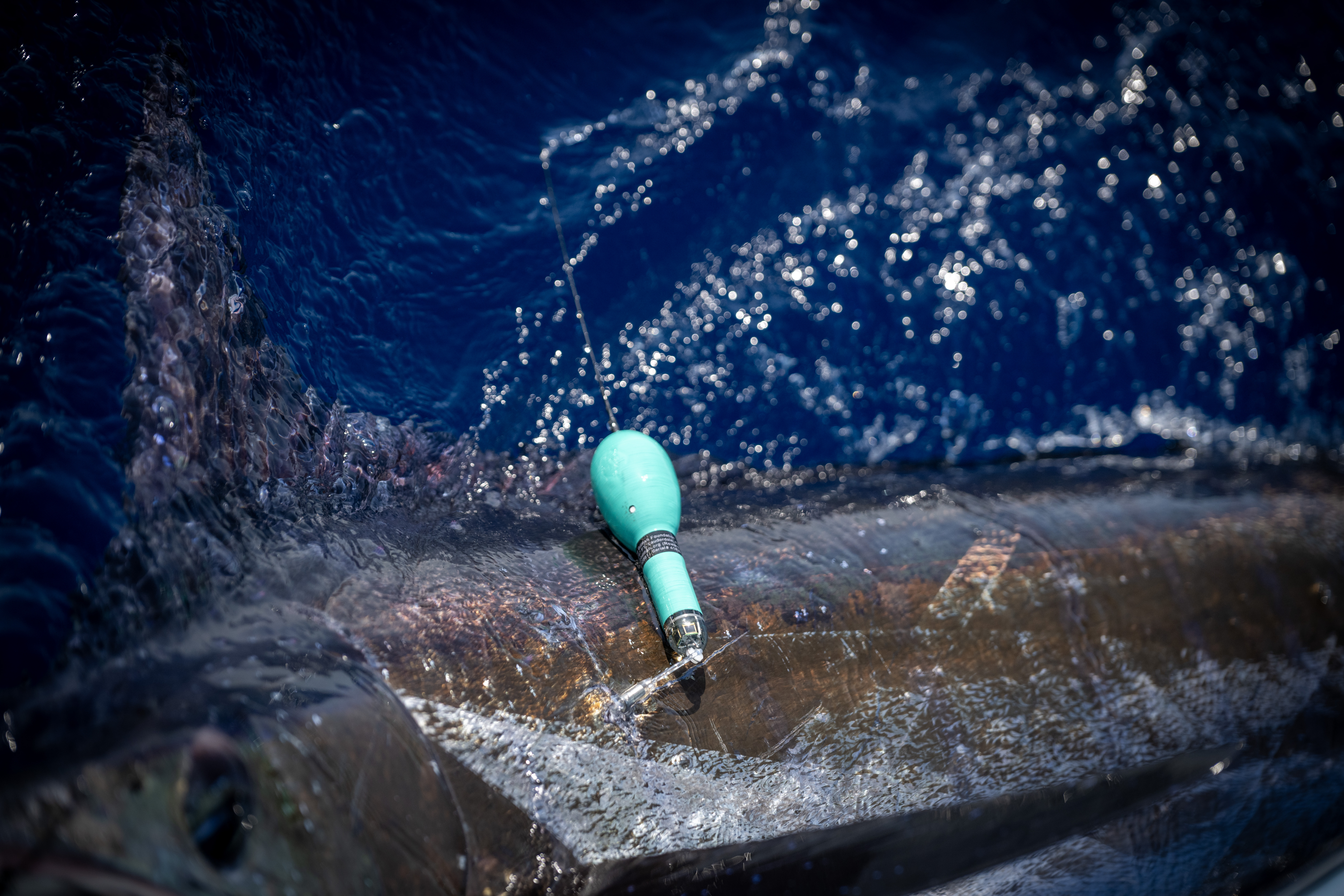
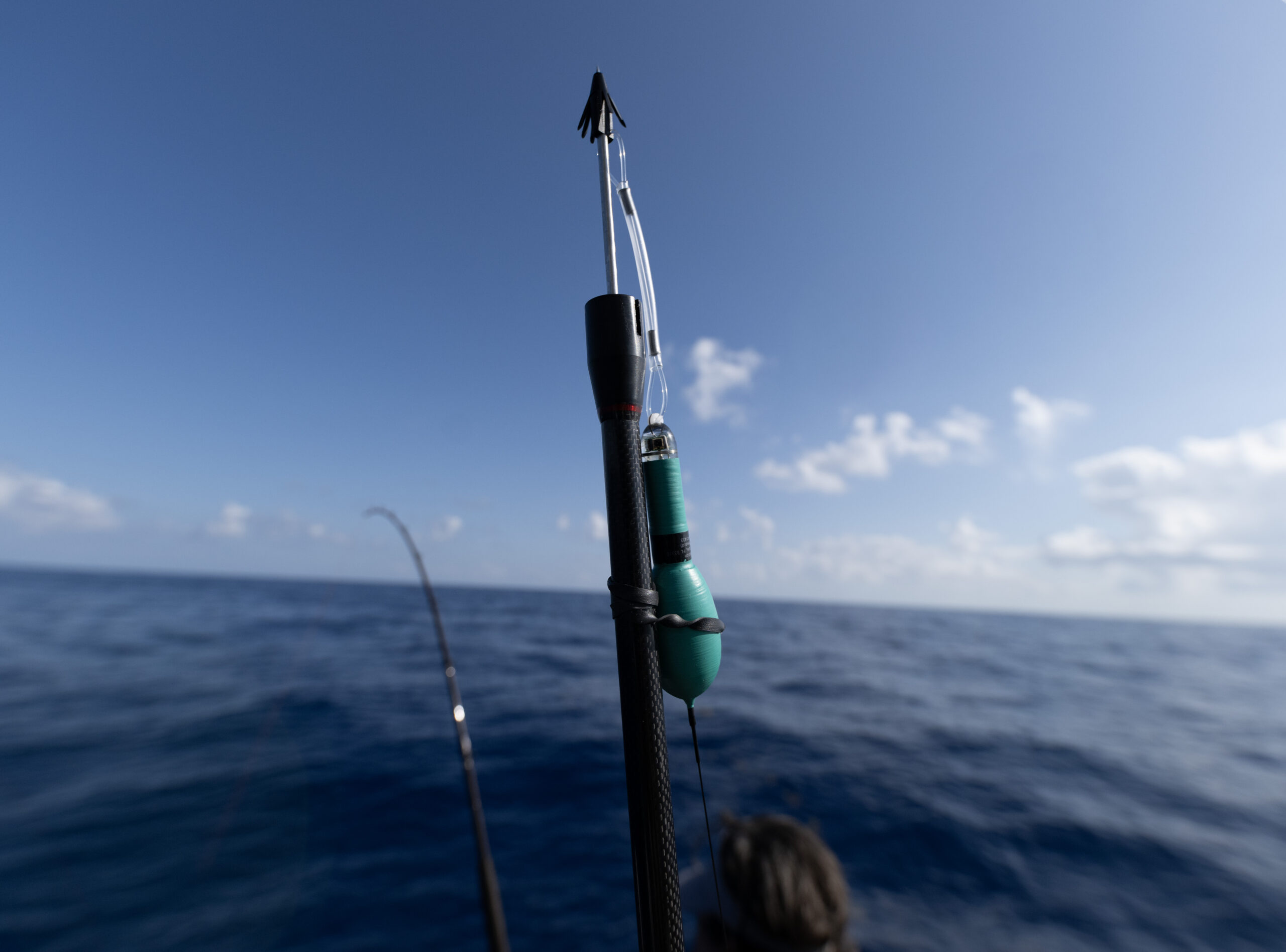
Pop-off archival satellite tags provide a much deeper look. The tags used during the South Texas expedition were programmed to record depth, estimated location and water temperature throughout each day. They can archive that information for up to 12 months. At the programmed time, the tag releases from the fish, floats to the surface and transmits its stored data through the CLS satellite system. Researchers can begin their analysis without physically recovering the tag.
That record can show whether a marlin stayed near the surface at night, made repeated dives during daylight, followed a temperature break or left the western Gulf entirely. Instead of two dots on a chart, researchers receive a track paired with a vertical history of the fish’s movements through the water column.
The Work Behind a Tag
A satellite tag begins producing useful science only after the crew finds a healthy fish, handles it correctly and releases it in strong condition. That makes tagging a true collaboration between anglers, captain, crew and biologists.
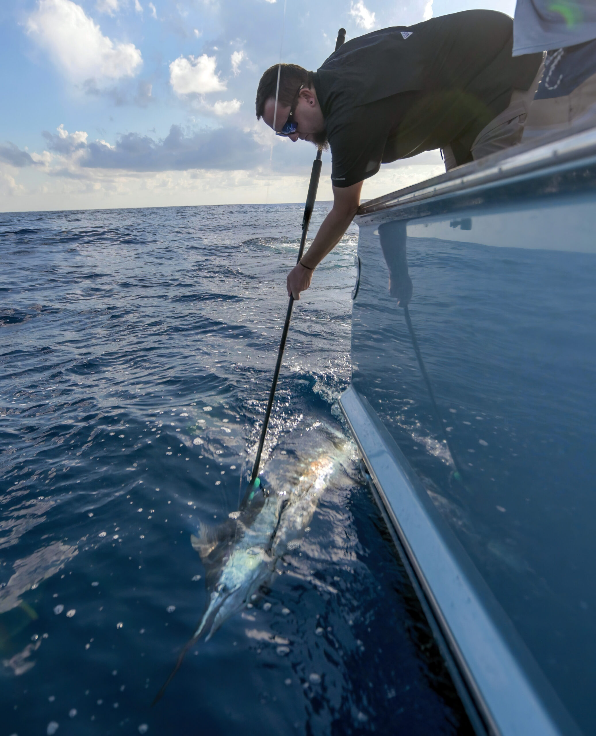
Out around the FADs, the fishing operation still has to work. The crew must locate activity, raise or hook a billfish, fight it efficiently and bring it alongside without exhausting it. Once the fish is controlled at the boat, the tagging team has a narrow window to place the tag properly and collect any additional information required by the research protocol. Every movement matters. A sloppy fight or prolonged boatside struggle can undermine the entire purpose of the work.
For an angler, the moment is intense. A marlin beside the boat is all color, muscle and controlled chaos. For the biologist, it is also a brief field station. The fish has to be assessed, tagged and released while the boat moves, the sea works and everyone stays clear of the bill and leader. There is no laboratory bench and no second take.
That pressure is part of what makes cooperative research effective. Scientists bring the study design and tagging expertise. Experienced offshore crews bring the ability to find, fight and safely handle the animals. Neither side can gather this kind of data as effectively alone.
Why the Texas FADs Deserve Attention
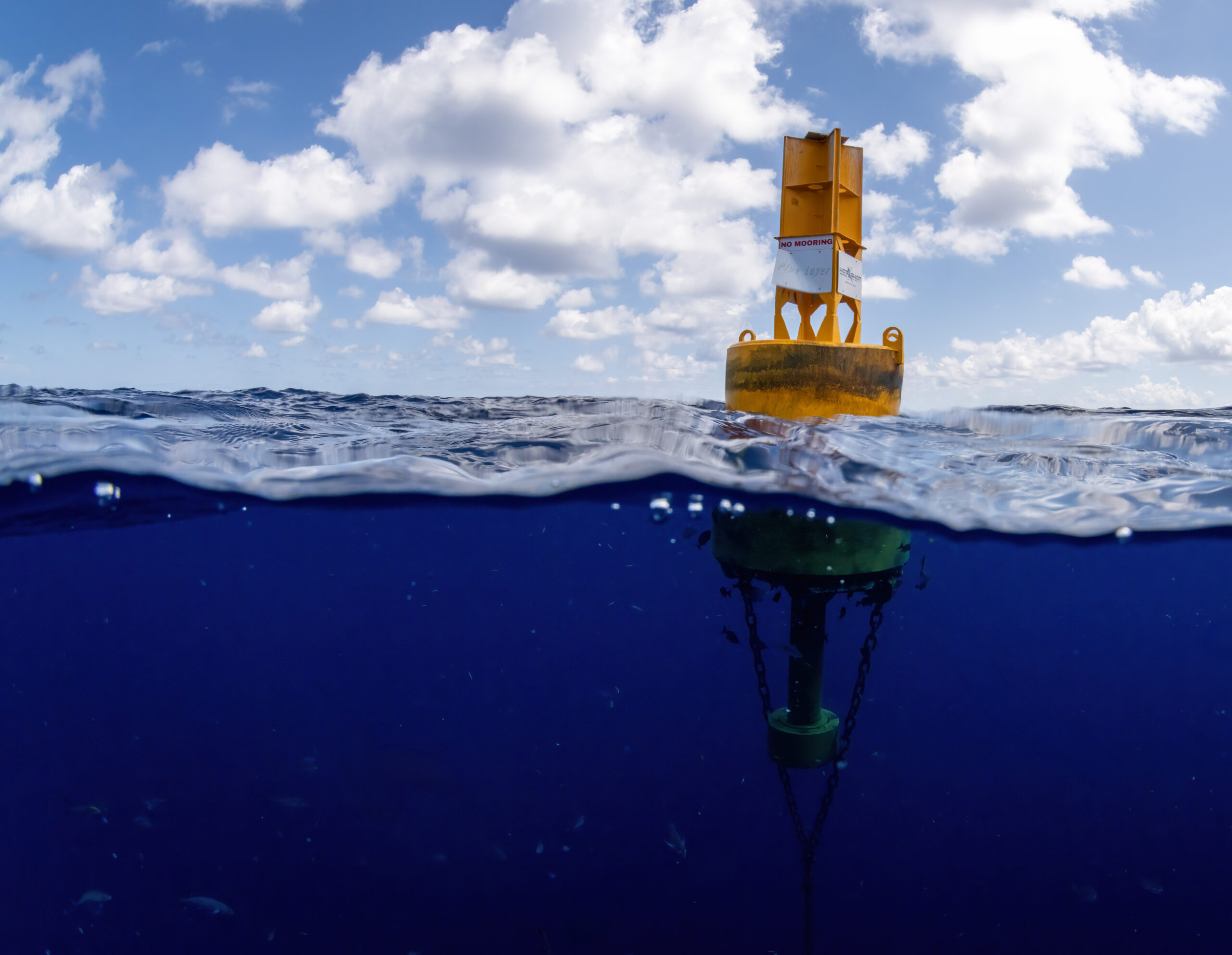
The Texas FAD network was impossible to ignore during the expedition. In deep water that may otherwise offer little physical structure, a FAD creates vertical relief through much of the water column. Small organisms gather around it. Baitfish follow. Then come tuna, wahoo, dolphin and billfish.
Higgs pointed out that artificial structures such as FADs and offshore rigs can serve a role similar to natural seamounts and pinnacles. They concentrate life and can become important habitat for pelagic species. That does not mean every fish remains tied to one structure, but it does make these locations important places to examine feeding behavior, residency and movement.
The research has practical implications. Offshore structures are installed, maintained and eventually removed. Future development decisions could change the amount and location of vertical habitat available in the Gulf. If satellite data show that billfish repeatedly use these features, managers and researchers will have stronger evidence when considering how new construction or structure removal could affect the broader offshore ecosystem.
The FADs also make the South Texas fishery accessible in a way that open-ocean hunting often is not. Captains can run to known positions and begin searching for bait, current and predators. That concentration creates fishing opportunity, but it also gives researchers reliable places to encounter the animals they need to tag.
A Fishery With More Story to Tell
South Texas has long been known for inshore fishing, shrimp boats, red snapper and the offshore oil patch. Its billfish fishery has never received the same national attention as better-known destinations in the eastern and north-central Gulf. The water around the FADs suggests that reputation is incomplete.
This expedition was an early step, not a final answer. Satellite tags need time at liberty before they release and transmit their archives. The tracks will have to be processed and compared with the team’s earlier work. A handful of movements cannot explain an entire population, and one season cannot define how billfish use the western Gulf year after year.
Still, the questions are now attached to fish moving through the Gulf. Do South Texas marlin remain in western waters? Do they move north and east across the basin? How closely do they associate with FADs and other offshore structures? Which temperatures and depths shape their daily behavior? The tags can begin replacing speculation with evidence.
For fishermen, that matters because good conservation depends on understanding the fish as they actually live. Catch data show when and where anglers encounter billfish. Satellite tags reveal what happens after the release, during the long stretches when no boat is watching.
The Release Is Only the Beginning
Watching a billfish swim away after tagging feels like the end of the encounter. Scientifically, it is the beginning. From that point forward, the fish carries a small instrument through a part of the ocean researchers cannot follow directly. Every dive, temperature change and movement across the Gulf adds another line to the story.
Higgs believes this work, combined with other billfish research in the Gulf, can help support the long-term sustainability of the fishery. Better movement and habitat data can inform future research, conservation priorities and decisions involving artificial offshore structures. It can also show how connected the western Gulf is to billfish habitat elsewhere in the region.
The Texas FADs gave us a place to find the fish. The anglers and crew created the opportunity. The tagging team turned that opportunity into data. Now the marlin will do the rest, carrying the research beyond South Padre Island and into the open Gulf.
Months from now, a tag may break free, reach the surface and begin transmitting. When it does, a fish we saw for only a few minutes beside the boat could reveal nearly a year of movement. That is the real power of satellite tagging: the release is not goodbye. It is the moment the story starts.
Contributor Credit
Scientific information and interview provided by Jeremy Higgs, assistant director of the Center for Fisheries Research and Development at the Gulf Coast Research Laboratory, The University of Southern Mississippi.